Graduate Students
Main Navigation
- Home
- Faculty and Staff
- Graduate Students
- Prospective Students
- News & Publications
- Contribute
-
Contact Us
Center for Wildlife Sustainability Research
Southern Illinois University
251 Life Science II
Mail Code 6504
Carbondale, IL 62901
618-536-7766
cwrl@siu.edu


Main Content
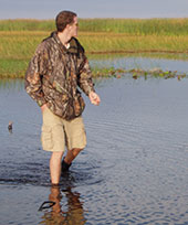
John O'Connell
Email: john.oconnell@siu.eduAdvisor: Dr. Mike Eichholz
Research Interest:
Using Remote Sensing to Determine Available Wetland Area for Waterfowl, Shorebirds and Marsh Birds
The hydrological variability of wetland systems drives their productivity, but can also limit resource availability for some avifauna. Simply put, if they are not wet when avifauna are trying to use them, then wetlands may not meet the needs for those species. Collecting accurate records of wetland inundation using ground survey methods can be labor intensive, and thus, is often not performed. Without detailed records of the extent of wetland inundation, it is impossible to estimate the available habitat for these wetland-dependent species. Classification of satellite-based synthetic aperture radar (SAR) imagery in conjunction with Landsat and ancillary GIS data has been shown to be a reliable and efficient method for mapping wetland inundation. We will conduct ground surveys, noting the extent of inundation at randomly selected sites throughout the state. A portion of the survey data will be used to build a classification model and different subset of the data will be used to assess the accuracy of the classifier. A successful model will serve as an efficient tool for the determination of inundation at statewide or larger scales, providing useful information for management decisions.